300 meters frtg on highway #307, Tulum, Q. Roo, MX
19 acres of Land with highway frontage
Certified Title | Primary Highway Access
$
415,000 USD (OR) 7,914,000 MXN
(pricing valid thru October 2018)
You can call: 984 247 4754
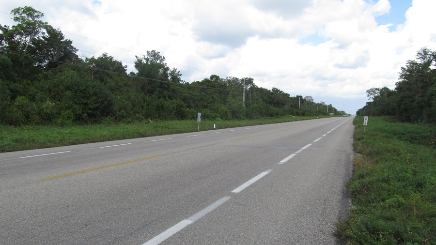
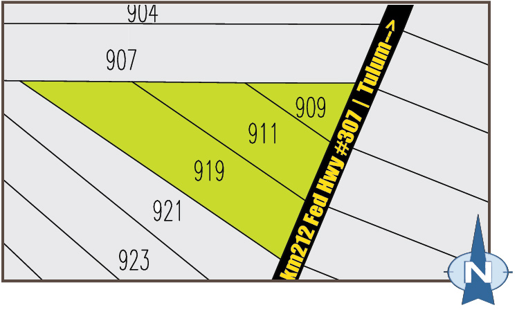
These three plots are situated with 984 ft of frontage on Mexico's federal highway #307 "Cancun-Chetumal" @ mile-marker-km212 about one-and-one-half miles Northwest of Laguna Nopalitos. This area is known as the Pino Suarez Highway Corridor.
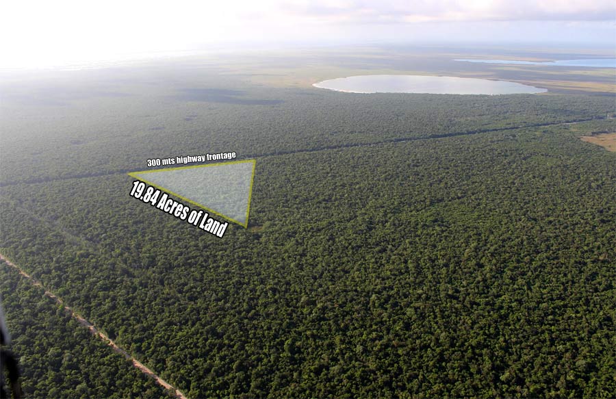
An aerial image with a Southeast facing camera viewing the land and the surrounging area.
Purchase lots individually or together for a discount.
Together these three lots offer 19 acres (80,000 square meters) of surface area with 300 meters of primary access frontage on hwy #307,cancun-chetumal @ km 212.
Certified Private Property Title. Land parcels are registered in the Public Registry of Commerce and Property of Quintana Roo.
Tulum Town Centre is 8 miles North of the property on the same highway. Playa Del Carmen with advanced services is 46 miles north. The international airport in Cancun (CUN) lies 88 miles north.
While in Tulum you can drive by the property at any time from the main Highway. The property's physical location is between marker km 212 and 211 Carr Federal 307 Cancun - Chetumal (parcela 919), Pino Suarez, Tulum, Quintana Roo Mexico. GPS 20.130184,-87.583439
Cash offers will be considered. Additional in-house financing. long term lease or a limited joint venture are options offered.
the Polygon in 3 Parcels
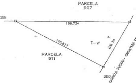
Parcel 909 Z1 P1/1
This plot is 2 acres in surface area and is priced individually at $129,000 US.
Parcel 909 Z1 P1/1 is legally recognized Private Property and proofed with a Title of Property issued by the Secretary of Agricultural Reform under authorization of the President of Republic of Mexico, Enrique Peña Nieto; on the 23rd of December 2013 with folio identification being #2557. This parcel is registered in the Public Registry of Property and Commerce of Quintana Roo with folio identification being #116701.
-
According to the title's certified survey work, the property has the following metes and bounds:
- (1)North: 196.735 mts with parcel 907.
- (2)Southeast: 100.54 mts with federal highway #307.
- (3)Southwest: 176.817 mts with parcel 911.
This land lot has a surface area of 8,863 square meters.
- 100 meters of first priority access to highway #307
- certified Title Deed – public registry receipt
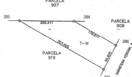
Parcel 911 Z2 P1/1
This plot is 6.6 acres in surface area and is priced individually at $244,000 US.
Parcel 911 Z2 P1/1 is legally recognized Private Property and proofed with a Title of Property issued by the Secretary of Agricultural Reform under authorization of the President of Republic of Mexico, Enrique Peña Nieto; on the 23rd of December 2013 with folio identification being #2562. This parcel is registered in the Public Registry of Property and Commerce of Quintana Roo with folio identification being #116690.
-
According to the title's certified survey work, the property has the following metes and bounds:
- (1)North: 200.411 mts with parcel 907.
- (2)Northeast: 176.817 mts with parcel 909.
- (3)Southeast: 99.825 mts with federal highway #307.
- (4)Southwest: 357.425 mts with parcel 919.
This land lot has a surface area of 26,719 square meters.
- 100 meters of first priority access to highway #307
- certified Title Deed – public registry receipt
Parcel 919 Z2 P1/1
This plot is 11 acres in surface area and is priced individually at $315,000 US.
Parcel 919 Z2 P1/1 is legally recognized Private Property and proofed with a Title of Property issued by the Secretary of Agricultural Reform under authorization of the President of Republic of Mexico, Enrique Peña Nieto; on the 23rd of December 2013 with folio identification being #02559. This parcel is registered in the Public Registry of Property and Commerce of Quintana Roo with folio identification being #00116643.
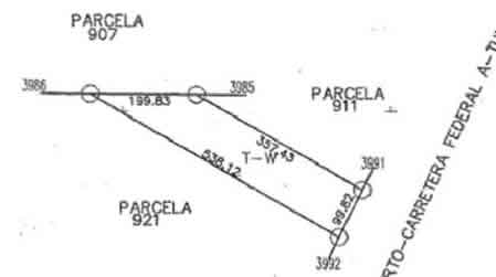
According to the title's certified survey work, the property has the following metes and bounds:
- (1)North: 199.83 mts with parcel 907.
- (2)Northeast: 357.43 mts with parcel 911.
- (3)Southeast: 99.82 mts with federal highway #307.
- (4)Southwest: 538.12 mts with parcel 921.
This land lot has a surface area of 44,712 square meters.
- 100 meters of first priority access to highway #307
- certified Title Deed – public registry receipt